Mount Timp is the second highest summit in the Wasatch Mountain Range at 11,749 feet after Mount Nebo (which we hiked last fall, written about here). Starting from the Aspen Grove trailhead, the hike to Mount Timp's peak is 8.3 miles one way.
I first hiked Mount Timp a few weeks into my freshman year at BYU with my awesome roommates and fellow ward members. It was a blast and completely exhausting. Somehow, Dustan never did the hike like so many freshman do.
 |
| Picture from my first time hiking Mount Timp |
We started out hike just after 1 am from the Aspen Grove trailhead. Dustan was able to sleep a couple hours, while I had been unable to fall asleep at all. We anticipated that the hike would take about 5 and a half hours, getting us to the peak just in time for sunrise at about 7:15 am.
The first half of the hike was rather uneventful. The full moon was quite bright, but it was still dark enough to prevent us from seeing the stellar views from the trail (I was the only one that wore a headlamp, too afraid I would twist my ankle on a rogue rock). After a few hours of hiking though, the elevation gain began to add to the frigidness of the air. We were surprised and curious when we began to smell fire smoke on the air. Soon enough, we came upon a little shack where a few boy scouts had built a fire. It was great to get inside and warm up for a bit.
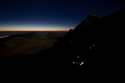
Until we had reached that shack, the hike had been rather uneventful. Just long. Then it began to get difficult. The next part of the trail was through a boulder field, filled with rocks of all sorts of shapes and sizes. The darkness from it being around 5 am and a thick layer of frost added with the already ankle turning boulder field quickly became a real pain. After slowly making our way through and losing the trail completely a few times, we hiked up a drastically steep hill that then met up with the other trail that leads up the mountain, the Timpooneke Trail. It was really neat to see the line of headlamps coming up the mountain from the view just above the steep path. Dustan of course stopped to take a picture while we continued on just a few minutes from there to the Timp Saddle.
The first time I hiked Mount Timp, I watched the sunrise from the Saddle before making my way to the peak. As it was last time, this spot was packed with people gazing at the panoramic views of Utah Valley. By the time we made it the Saddle, the sky was significantly lighter. We quickly began the zig zag path up the the summit.
And this is where Ashlee and I began to crash. We still aren't sure if we were experiencing altitude sickness, exhaustion because we had colds, or just awful because we hadn't drank enough water on the hike up. But we felt seriously sick--dizzy, nauseous, no energy, blacking out, the whole deal. We sent the boys up ahead of us so that they could make it up for sunrise for sure, while we began slowly making our way up and taking lots of breaks.
By some miracle we were able to make it up and sit with our husbands just minutes before the sun peaked over the mountains in the distance. It was beautiful :) Annnd absolutely freezing. With such high elevation and exposure to the wind, we think the weather was in the low 20s that morning (according to google).
We took some pictures, signed the book in the shack on the peak, then headed back down to the Saddle to take a small break.
The way back down was slow going. The hike back down those 8.3 miles, now in the light, seemed to last so much longer. At least we had many great views of mountain goats, the Valley, and waterfalls to distract us.
After reaching the bottom, we went straight to Five Guys for some well deserved burgers and fries :) Now that we have done Mount Timpanogos together, we plan on never hiking it again! Which is just fine with us. And it was a good thing that we hiked it that weekend--just a week later, this is what Mount Timp looked like!


